![](/images/other/stat-length.png)
![Tocht Te voet okres Košice II - Náučný chodník Mestskej časti Košice - Sídlisko KVP - Photo](https://media.geolcdn.com/t/1900/400/275c3362-bcc2-4b48-8df5-d095606e5538.jpeg&format=pjpeg&maxdim=2)
Náučný chodník Mestskej časti Košice - Sídlisko KVP
SityTrail - itinéraires balisés pédestres
Tous les sentiers balisés d’Europe GUIDE+
![Lengte](/images/other/stat-length.png)
Lengte
3 km
![Max. hoogte](https://static1.geolcdn.com/siteimages/upload/files/1508320355ic_sort_altitude_max_24dp.png)
Max. hoogte
326 m
![Positief hoogteverschil](https://static1.geolcdn.com/siteimages/upload/files/1508320355ic_sort_den_pos_24dp.png)
Positief hoogteverschil
66 m
![Km-Effort](/images/other/stat-length.png)
Km-Effort
3,8 km
![Min. hoogte](https://static1.geolcdn.com/siteimages/upload/files/1508320355ic_sort_altitude_min_24dp.png)
Min. hoogte
273 m
![Negatief hoogteverschil](https://static1.geolcdn.com/siteimages/upload/files/1508320355ic_sort_den_neg_24dp.png)
Negatief hoogteverschil
19 m
![Boucle](https://static1.geolcdn.com/siteimages/upload/files/16400158638029165_repeat_loop_refresh_sync_direction_icon.png)
Boucle
Neen
Markering
Datum van aanmaak :
2025-02-06 14:53:18.761
Laatste wijziging :
2025-02-06 14:53:18.761
![Te voet](https://static1.geolcdn.com/sitytour/trail-icons/100.png)
51m
Moeilijkheid : Gemakkelijk
![Scan deze QR-code om de tocht te openen in de SityTrail-applicatie](https://capi.geolives.com/qq0zvz2zws4bq2lad0pu/sitytour/trails/4343263/qr.png?size=200)
Gratisgps-wandelapplicatie
Over ons
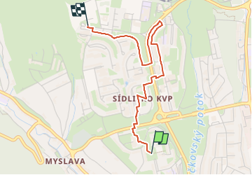
Tocht Te voet van 3 km beschikbaar op Košický kraj, Košice, okres Košice II. Deze tocht wordt voorgesteld door SityTrail - itinéraires balisés pédestres.
Beschrijving
Tocht aangemaakt door Miestny úrad KVP.
no symbols, map depicted on boards is very inaccurate, some board positions are completely off, this relation is best effort to connect all boards in the order intended
Plaatsbepaling
Land:
Slovakia
Regio :
Košický kraj
Departement/Provincie :
Košice
Gemeente :
okres Košice II
Locatie:
Košice - mestská časť Sídlisko KVP
Vertrek:(Dec)
Vertrek:(UTM)
515787 ; 5395178 (34U) N.
Opmerkingen
Wandeltochten in de omgeving
![Tocht Te voet okres Košice I - Vrabčie skaly - Photo](https://media.geolcdn.com/t/375/260/7451ea83-a1e3-4ace-a0e3-957f0ef3aa62.jpeg&format=jpg&maxdim=2)
![Te voet Te voet](https://static1.geolcdn.com/sitytour/trail-icons/100.png)
Vrabčie skaly
Te voet
Gemakkelijk
okres Košice I,
Košický kraj,
Košice,
Slovakia
![](/images/other/stat-length.png)
4,9 km | 7,7 km-effort
1h 44min
![](https://static1.geolcdn.com/siteimages/upload/files/16400158638029165_repeat_loop_refresh_sync_direction_icon.png)
Ja